
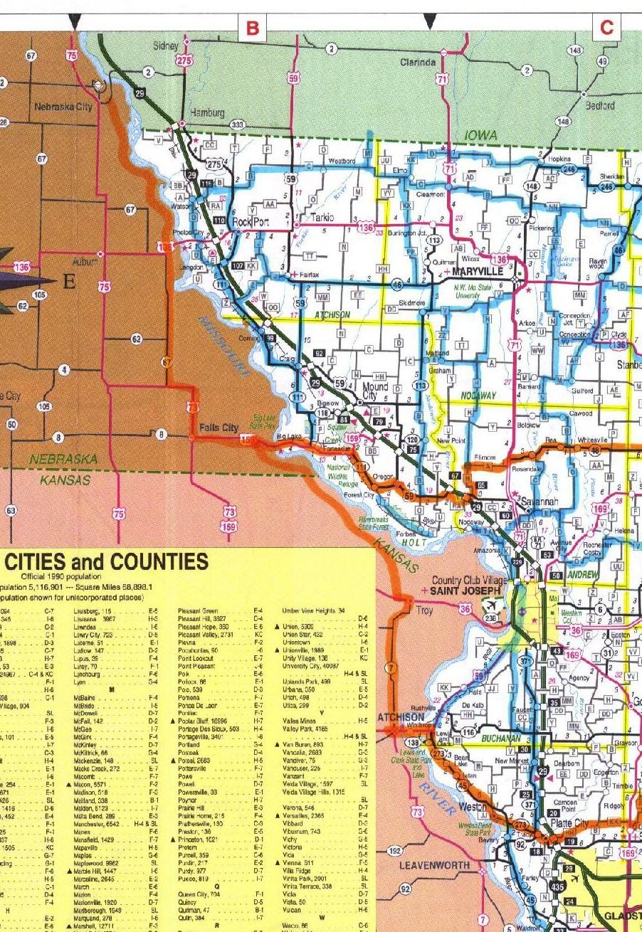
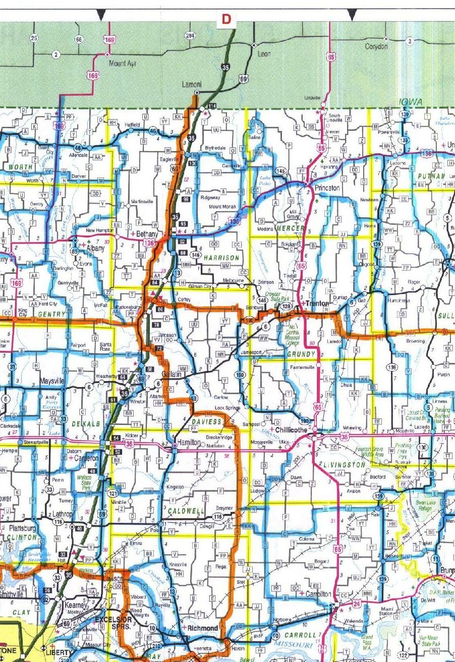
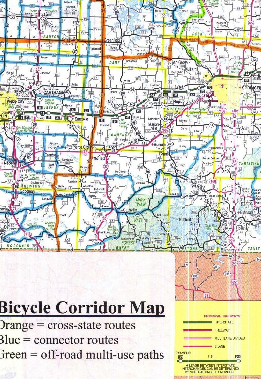
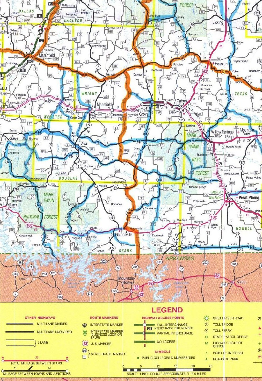
Proposed Missouri Cross-State Bicycle Routes--QUARTER-SIZED MAP
[ Missouri Bicycle Federation Home Page | Missouri bicycle maps page | About the proposed bicycle routes | Printable PDF file of the route maps (12 pages; 5.5 meg) ]
This is the quarter-sized version of the Missouri Statewide Bicycle Route Map, a map of the entire state of Missouri showing a complete network proposed cross-state bicycle routes that may be relatively favorable for bicycling by experienced touring cyclists. Please scroll down to view the map.
IMPORTANT NOTES:
- These proposed cross-state bicycle routes have been offered to the MoDOT Bicycle/Pedestrian Advisory Committee by the Routes Subcommittee. The routes have been selected on the basis of average daily traffic volume data and topography. The routes have not been ground-tested. They are not approved by MoDOT. They are offered purely for consideration, comment, and suggestion by cyclists across the state.
- The proposed routes would be intended for use by experienced touring cyclists.
- The final map will include a rating of the "bicyclability" of the various proposed routes based on factors like traffic volume, road width, availability of shoulders, and so on. This information is not on the current draft. Be aware that the bicyclability (or "bicycle friendliness") of the indicated routes is known to vary widely; in some areas it is very poor.
- The statewide map used as the basis for this map omits some minor roads used as part of the proposed routes. For instance, the proposed route along I-44 ("Route 66") runs mostly on frontage roads and side roads not shown on the base map.
- MoBikeFed is working actively with MoDOT to consider cyclist feedback in the development of these proposed routes. Please click here to leave any suggestions, alternative routes, or general feedback on our comment board. You can also email Brent Hugh, president@mobikefed.org, or send written comments c/o Missouri Bicycle Federation, Inc., Post Office Box 104871, Jefferson City, MO 65110-4871.
Orange routes--proposed cross-state bicycle routes; "bicycle freeways"
Blue routes--secondary bicycle routes, routes interconnecting major Missouri cities
Green routes--off-road multi-user paths, like the Katy Trail
Click any sector to view a full-sized JPEG file of that sector.
Each of the 15 sectors is designed so that it can be printed legibly on an 8 1/2 X 11 sheet of paper.
Once you have completely loaded one version of the map you can instantly switch between quarter, half, and full sizes (all maps use the same graphics files)
[Full-sized map
| half-sized map
| quarter-sized map
| Printable PDF file of the route maps (12 pages; 5.5 meg)
]
 |
 |
 |
 |
 |
 |
 |
 |
 |
 |
 |
 |
 |
 |
 |
Once you have completely loaded one version of the map you can instantly switch between quarter, half, and full sizes (all maps use the same graphics files)