Butterfield Stage Experience 500 Bicycle Route? Not officially (yet) but...try an early, unofficial draft of the Springfield MO-Ft Smith AR route (240 miles)
[UPDATE October 2022: The OFFICIAL Butterfield Stage Route through NW Arkansas will soon be announced. For now we have removed the unofficial, early draft route. As soon as the official route is announced, we will link to that official route here!]
The Butterfield Stage Experience mostly-gravel bicycle route, 250 miles Jefferson City to Springfield, has been an amazing success for Missouri and for Butterfield Trail communities since it was announced in 2018.

Now - thanks to an amazing group of leaders and organizers in southwest Missouri and northwest Arkansas - we are looking at having the next 250 miles of the Butterfield Trail turned into an officially adopted bicycle route, by December 2022.
")
Features of the Butterfield Stage Route through northwest Arkansas


- Hundreds of historic sites and places to visit along the way included as GPS Points of Interest - including photos, old maps, summary of history, detailed directions for finding obscure locations, and the other things you'll want to know when you arrive at a historic location.
- Takes you to both Wilson's Creek National Battlefield and Pea Ridge Military Park. At these two locations - both located on the Butterfield Trail - two of the most significant Civil War battles west of the Mississippi were fought. Both are well-developed National Parks, with many authentic buildings, pieces of military equipment, and interpretive displays. And: Both have some of the best, most pristine, and beautiful sections of the old Butterfield Trail that still exist.
GPS Route Files


- GPS route for the first completed section of the Butterfield Stage Experience bicycle route - 250 miles Jefferson City-Springfield, Missouri.
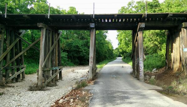
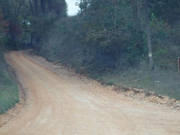
 Preserved section of the old Butterfield Trail near Clever, MO. On the trail Wilson's Creek Battlefield, Clever, Crane, Osa, Cassville, and Washburn MO to Pea Ridge AR is some of the most beautiful and well-preserved sections of the Butterfield Trail in Missouri.
 - GPS route files for the official Butterfield Route through Arkansas coming soon!


The Butterfield Trail followed this valley, southwest of Wire Road Conservation Area, Missouri

View from the Butterfield Trail, southwest Missouri

Butterfield Trail near Osa, MO

Near Wire Road Conservation Area, Missouri.

Southwest of Wire Road Conservation Area, Missouri. The Butterfield Trail follows this long, shallow valley southwest towards Cassville.
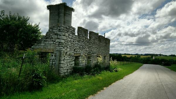
West entrance to Wire Road Conservation. The Old Wire Road/Butterfield Trail ran straight up this road, directly through the current Conservation Area. A Civil War skirmish leading up to the Battle of Pea Ridge took place at Crane Creek, just on the far side of this photo.
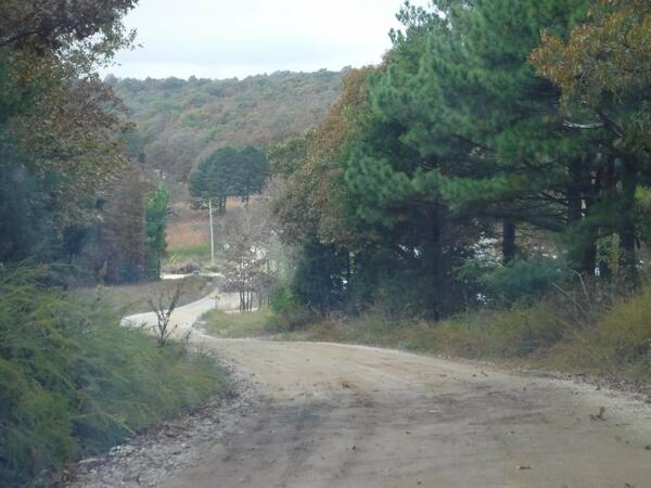
Arkansas mountains, between Fayetteville and Fort Smith
Preserved trail crossroads near Rogers, Arkansas
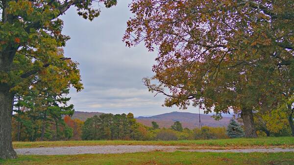
Scenic view from the Arkansas Ozarks.
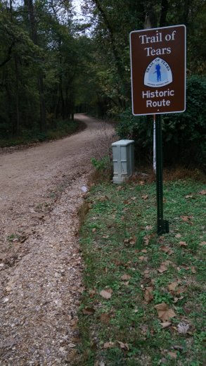
Throughout much of the route between Springfield and the Fayetteville area, the Trail of Tears route to Oklahoma followed the Butterfield Trail. In this area, the road was also known as the "Wire Road" or "Old Wire Road" because the first telegraph lines followed the road, and the "Military Road" because it led to Fort Smith.
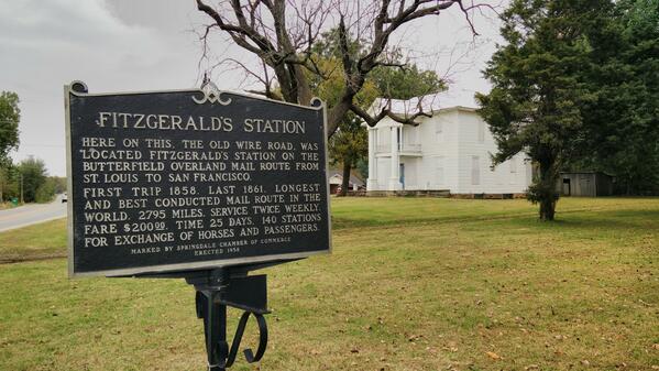
Fitzgerald's Station was directly on the Wire Road. The extensive grounds are now owned by the City of Springdale, which is working to restore the buildings and open them to the public. Visitors can enjoy the grounds now - and Fitzgerald's Station is one of the must-see stops on the route.
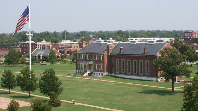
Fort Smith, Arkansas, is as beautiful and fitting endpoint for this section of the Butterfield Stage route. Fort Smith, established in 1817, is a National Historic Site with numerous exhibits and preserved buildings open to the public. For decades, the fort was the far western outpost of the United States government. The City of Fort Smith and adjacent Van Buren have a long and fascinating history. With many historic homes, buildings, museums, and sites to visit - everything from the Cherokee Heritage Center to the Museum of History to the Air Museum and the United States Marshals Museum to Miss Laura's and the Elvis Barbershop Museum. You may want to plan an extra day or two.
Creating a world-class bicycle, pedestrian, and trails transportation network across Missouri is one of the four major goals of MoBikeFed's Vision for Bicycling and Walking in Missouri. Creating, promoting, and encouraging the implementation of the statewide trails vision along with major trails like the Katy Trail and Rock Island Trail along with developing and maintaining statewide bicycle touring routes like the Birthplace of the Santa Fe Trail Bicycle Route, Butterfield Stage Experience, and many others--which often create connections between our major trail and existing bicycle route systems--are vitally important parts of that plan.
Working to connect Missouri bicycle and touring routes to major national routes is another part of our work. These include: U.S. Bicycle Routes such as USBR 76, USBR 66, and USBR 61; existing well-used routes like the Lewis & Clark Trail, the Mississippi River Trail, and the American Discovery Trail; and new and developing routes that we are working to promote and instigate as major regional or national routes, such as the national Butterfield Stage Experience bicycle route, the Santa Fe Trail bicycle route, the Pony Express bicycle route, bicycle routes along designated U.S. Historic Trails like the Oregon Trail and California Trail, and others.
Your ongoing membership and generous financial support help turn our Vision into reality!
Join MoBikeFed's Advocacy Network
Working together we make a real difference! Join our advocacy network:
Related pages
Current topics...
Archives...

